Thursday, July 21
On the Road to Valdez (That's pronounced Val Deez not Val Dez)
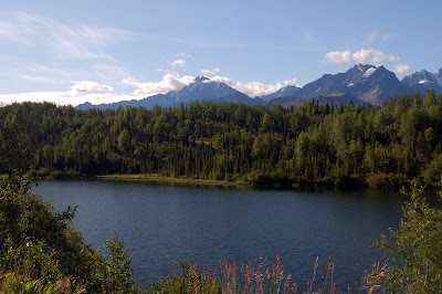
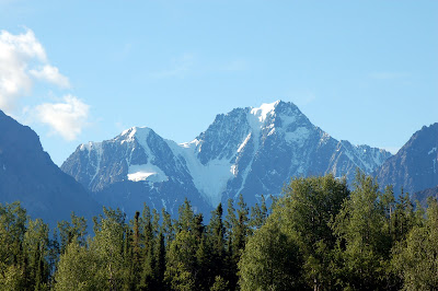
The blog today will be mostly done with the camera. While the pictures may look OK, they cannot begin to capture the true beauty of what we saw today. Multiply what you see by 100 and you might be close.

 Our 260 mile drive was one of the most spectacular drives we have taken on this trip, and that is saying a lot. We left Palmer around 8:30 and headed 140 miles east on Highway 1, also known as the Glenn Highway.


kalZF_UZI/AAAAAAAAUGE/GstLAoR3s0k/s1600/DSC_0046.JPG'>

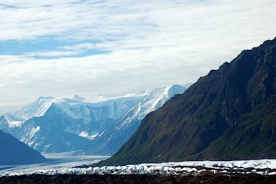
Highways in Alaska have numbers, but they are referred to by name. Almost immediately after leaving Palmer the road began to rise as we entered the Chugash Mountain Range. These mountains are very high with deep valleys and the Mantanuska River runs through the bottom. We had several steep inclines and declines with 7-9 percent grades. Rushing rivers and streams fed into the Mantanuska in many places along the road. After about 75 miles we reached the Mantanuska Glacier.

This glacier is several miles long and comes from deep within the Chugash chain. The mountains back in that area were entirely covered with snow. There were many breathtaking views along this stretch.
From the Mantanuska Glacier on to the end of the Glenn Highway in Copper Valley the highway was plagued with frost heaves. Frost heaves are areas where the road has been jacked up by the frozen ground and then it settles back down when it thaws. This causes washboarding and very rough spots in the highway. This lasted for close to 65 miles.


After a nice lunch in Copper Valley, we turned onto the Richardson Highway (Highway 4) for the 120 mile drive down to Valdez. The first 75 miles were similar to the last part of the Glenn Highway - lots of frost heaves. Driving 55 mph and pulling a 5th wheel leads to becoming momentarily airborne when he hit a frost heave.

We past the Worthington Glacier as we neared Valdez. This glacier runs for miles back up into the Chugash Mountains also.
The road began to climb as we reached the Worthington Glacier until we finally reached the Thompson Pass which is at 2763 ft. of elevation. Going through the Thompson Pass led us to a 7 1/2 mile downhill run into the Keystone Canyon. The walls of the canyon paralleled the road for several miles as we came into Valdez. Waterfalls were everywhere as we came through the canyon, but we stopped to get pictures of the two highest and most spectacular
 - Bridal Veil Falls and Horsetail Falls.
The town of Valdez is probably the most modern town in Alaska. The down was completely destroyed in an earthquake in 1964. Following the quake it was determined that the area where the town was located was not stable ground and was subject to destruction in another quake. The whole town was moved about 6 miles on down Prince William Sound. Paractically every building in town has been build since 1964. Valdez is also the home to the northern=most ice free harbor in Alaska. Because of this the Trans-Alaska Oil Pipline terminal is located in Valdez. The harbor is deep enough to handle supertankers to take oil to the mainland U.S.
Our RV Park is located downtown right across the street from the small boat harbor.

 We are able to walk everywhere in town! Tomorrow we are going across the street to load a boat for a 9 hour cruise to the glaciers and to see sealife. People returning from the same tour today said they waw 3 different kinds of whales in addition to lots of other wildlife. Here's hoping!! I'll let you know what we see in tomorrow's blog. Til then - Happy Trails!
We have a good Wifi connection now so hopefully the blogs will be on time again. Keep your fingers crossed.

No comments:
Post a Comment